
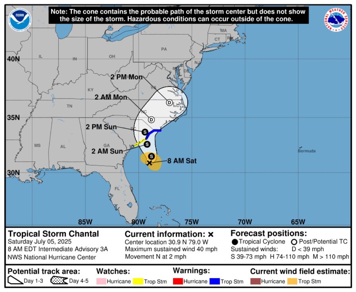
Tropical Storm Chantal made landfall on the east coast of the United States early Sunday, raising concerns about flash flooding, high winds and dangerous conditions at sea, according to warnings issued by the Miami-based National Hurricane Center (NHC).
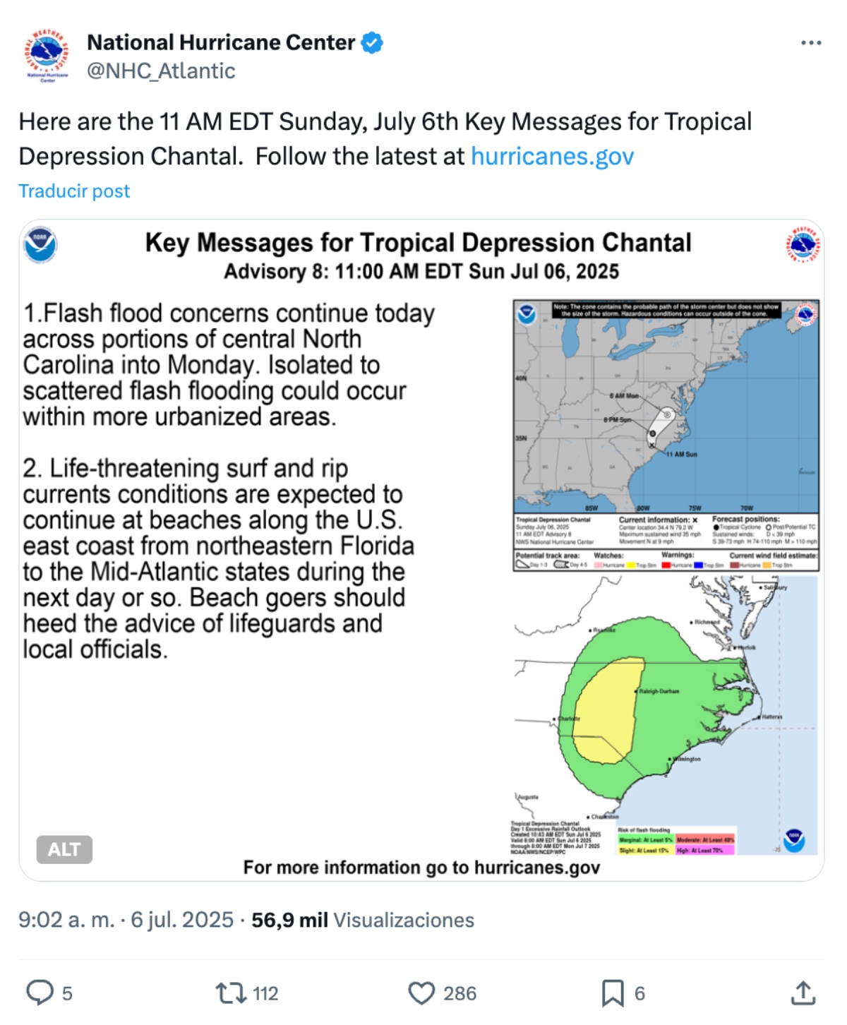
According to the most recent NHC bulletin, Chantal could intensify in the next few hours and make landfall in South Carolina during Sunday morning.
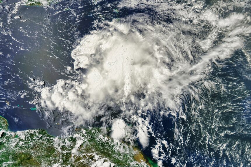
Where is Chantal and how is she progressing?
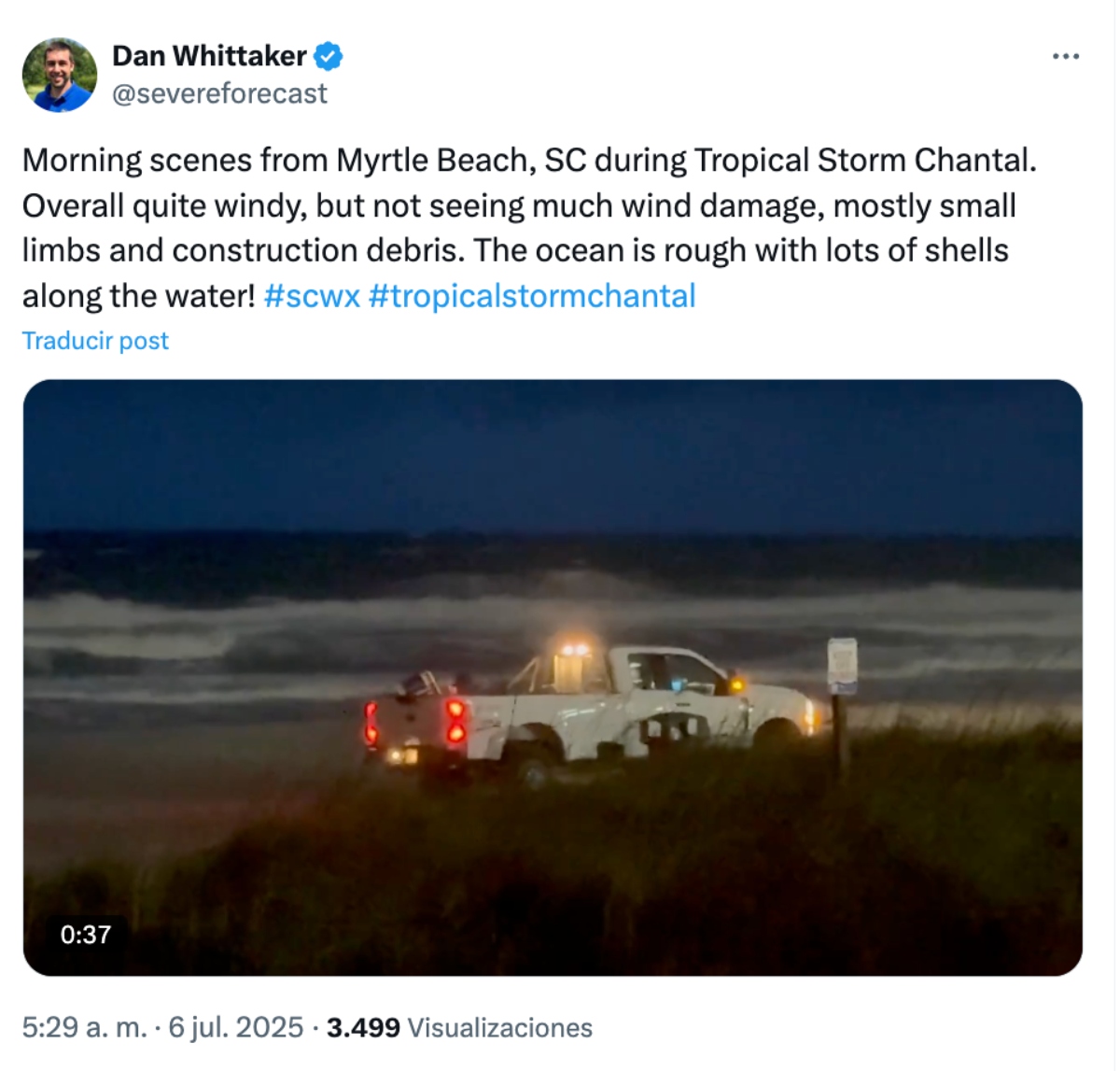
Storm Chantal made a direct hit on Litchfield Beach, South Carolina, with sustained winds of up to 50 miles per hour (80 km/h), bringing heavy rain and high surf.
The NHC issued tropical storm warnings for coastal areas ranging from South Santee River, South Carolina, to Surf City, North Carolina.
The system will continue to move inland into the southeastern United States, maintaining stormy conditions through Sunday morning, with thundershowers expected through Monday.
Areas under alert and expected conditions
Weather authorities warned of the possibility of flash flooding in low-lying areas of northeastern South Carolina and much of North Carolina, particularly in coastal and flat areas.
Total rainfall accumulations of 2 to 4 inches (5 to 10 cm) are expected, with some locations receiving up to 6 inches (15 cm).
This level of precipitation could saturate drainage systems and cause power outages or road blockages.
In addition, dangerous marine conditions are forecast along the coast, with violent swells and rip currents that can be life-threatening.
Coastal areas from northeast Florida to the mid-Atlantic states could be affected by this phenomenon during the next 24 to 48 hours.
Coastal impact images

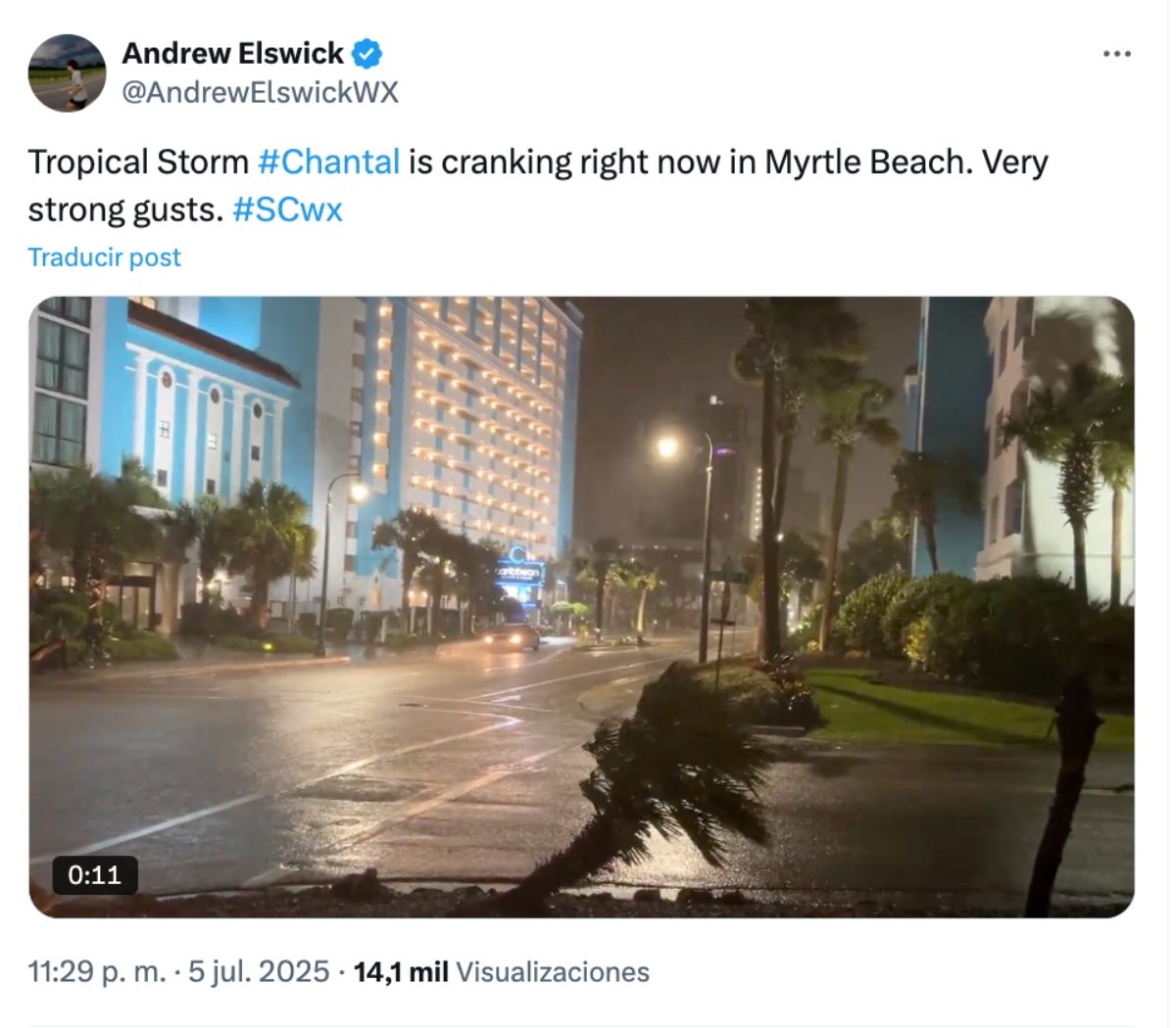
Videos taken from North Myrtle Beach, South Carolina, show how the winds whipped hard along the coastline, kicking up sand and tipping palm trees as lightning lit up the sky.
Wind gusts of 25 to 30 miles per hour were recorded, creating a tense environment for residents and tourists.
By Saturday afternoon, prior to impact, the system had already begun to generate heavy rains in the coastal plains of the Carolinas, a situation that worsened during the night with the direct entry of the tropical cyclone.
What to do if you live in the affected area?
Local and federal authorities advise residents in areas under warning to avoid traveling on flooded roads, stay away from the coast, and closely follow evacuation or temporary shelter instructions in case further orders are issued.
The National Weather Service reminds that rip currents are not always visible, and can easily sweep away experienced people in the water.
The general recommendation is not to enter the sea until the authorities deem it safe.
Recommendations for Hispanic residents
Latino communities residing in coastal areas should pay special attention to bulletins from the NHC and local authorities.
Although the system has not yet made landfall, its rapid evolution could require preventive evacuations or emergency measures.
Key tips:
Verify that your family emergency plan is ready.
Have flashlights, batteries, drinking water and non-perishable food on hand.
Secure loose objects outside that can blow away in the wind.
Avoid driving through flooded areas.
Tropical Storm Chantal marks the first major weather event of this hurricane season, although on July 4 heavy rains caused the Guadalupe River to overflow its banks in Texas, leaving 70 people dead and dozens missing.
According to NOAA it will be more active than normal, with up to 19 named storms and 10 hurricanes projected between June and November 2025.
For real-time information and official updates in Spanish, please visit: www.nhc.noaa.gov/?lang=es.
Los vientos azotaron con fuerza la línea costera, levantando arena e inclinando palmeras mientras relámpagos iluminaban el cielo